Last Updated on August 2, 2025 by Brian Beck
Colorado Springs has been unusually wet this year—not because the total seasonal rainfall is dramatically above average, but due to several specific weather factors aligning in spring and early summer.
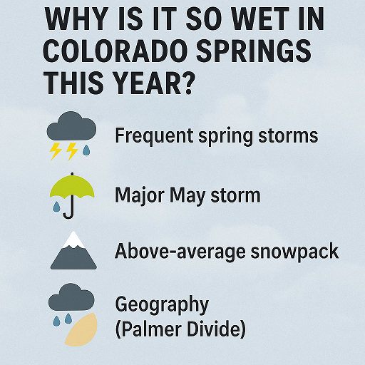
Key reasons for the wetter-than-normal feel:
-
Frequent, persistent spring storms delivered near-daily rain events in May—from May 5–7 especially, when eastern Colorado saw over 1.5″ of rain and areas just west of Colorado Springs received more than 3″ in just 48 hours Redditclimate.colostate.edu. That storm significantly improved a prior dry setup for southern Colorado KOAA News 5.
-
An unusually active and cool May across Colorado brought more storms than usual, including snow—Pikes Peak got over 4 feet early in May, with rapid melt adding runoff and moisture around the springs region KOAA News 5.
-
Cloudier, wetter pattern with steady showers made the season feel much greener, even though total precipitation through spring wasn’t far off: Colorado Springs logged 4.25″ from March–May, just 0.02″ above normal, ranking it as the 60th‑wettest spring—not an outlier in totals, but notable in consistency National Weather Service.
-
Local geography (Palmer Divide influence) enhances precipitation around Colorado Springs, especially during active weather, compared to surrounding plains en.wikipedia.org+5en.wikipedia.org+5en.wikipedia.org+5.
-
Broader climate trends: While the Southwest overall is experiencing drought, climatologists note climate change is increasing the intensity and frequency of storms—and shifting precipitation northward and eastward across the U.S., making localized “wet spells” more likely even in typically semi-arid regions en.wikipedia.orgen.wikipedia.org.
🌦️ Summary Table
| Factor | What happened |
|---|---|
| Frequent storms | Many small daily rain/snow events—not just a few big storms |
| Major May storm | 3″+ precipitation near Springs in early May was significant |
| Above-average snowpack | Winter and spring snowfall above normal, with rapid spring melt |
| Geography | Palmer Divide boosts precipitation in local microclimate |
| Climate trend | Warmer atmosphere holding more moisture → more intense storms |
Despite the wet feeling, precipitation totals remain close to historical averages—but the steady rain, cooler temperatures, and local storm systems created the impression of a much wetter spring. That moisture helped ease drought in the region, though overall the broader Southwest remains dry weatherspark.com+8National Weather Service+8climate.colostate.edu+8National Weather Service+1washingtonpost.com+1.
As summer approaches, typical monsoon patterns may bring more moisture—but it may also shift to hotter and drier spells, depending on how the jet stream and Gulf‑of‑California moisture setup evolve.